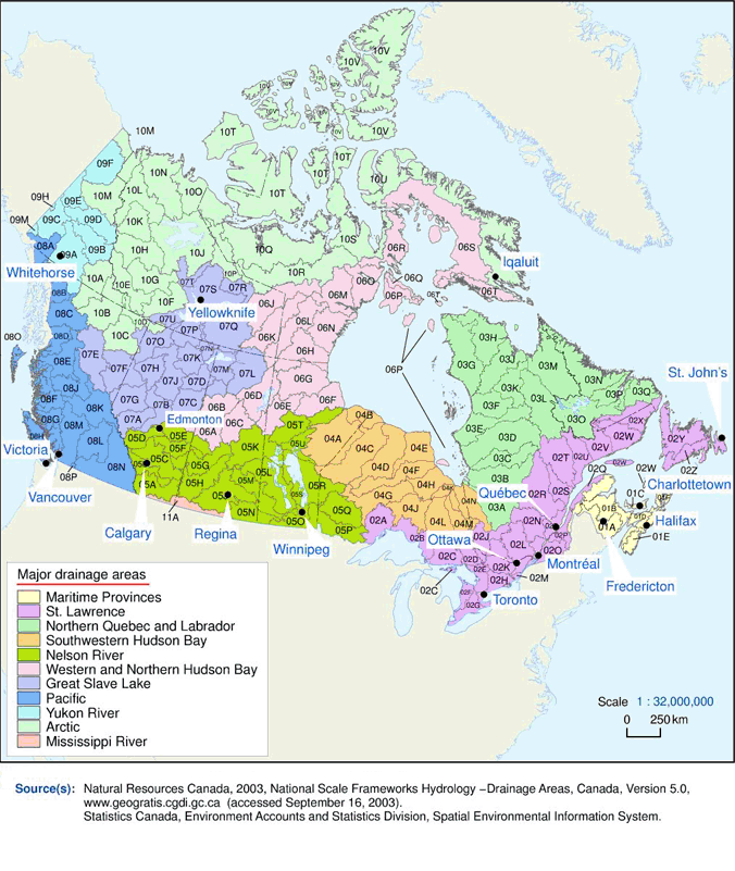
This map outlines the boundaries of the 11 major drainage areas and the 164 sub-drainage areas in Canada. These drainage areas cover all the land and interior freshwater lakes of Canada.

Description of major drainage areas and sub-drainage areas map of Canada
This map outlines the boundaries of the 11 major drainage areas and the 164 sub-drainage areas in Canada. These drainage areas cover all the land and interior freshwater lakes of Canada.
Major drainage areas
- 01
- Maritime Provinces
- 02
- Canada part St. Lawrence
- 03
- Northern Quebec and Labrador
- 04
- Southwestern Hudson Bay
- 05
- Nelson River
- 06
- Western and Northern Hudson Bay
- 07
- Great Slave Lake
- 08
- Pacific
- 09
- Yukon River
- 10
- Arctic
- 11
- Mississippi River