The Statistical Area Classification (SAC) - Variant of SGC 2021 groups census subdivisions (CSDs) according to whether they are a component of a census metropolitan area (CMA), a census agglomeration (CA) or a census metropolitan influenced zone (MIZ).
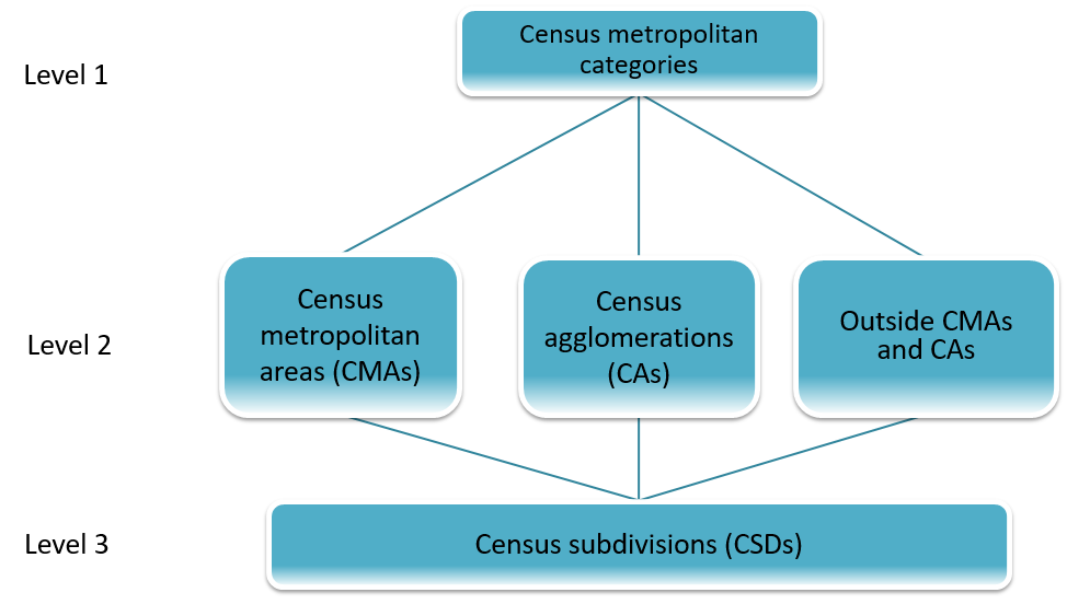
CSDs form the lowest level of this classification variant. The next level of this classification variant consists of individual CMAs, CAs and MIZs. The highest level of this classification variant consists of three categories that cover all of the landmass of Canada:
- CMAs (Canada)
- CAs (Canada)
- Outside CMAs and CAs, also known as the MIZs (Canada)
The SAC provides unique numeric identification (codes) for these hierarchically related geographic areas. It was established for the purpose of reporting statistics. The hierarchical relationship of the geographic areas is shown in Figure 2.

Description of Figure 2
- Level 1 - Census metropolitan categories
- Level 2 - Census metropolitan areas (CMAs), Census agglomerations (CAs), Outside CMAs and CAs
- Level 3 - Census subdivisions (CSDs)
Census metropolitan area and census agglomeration
A Census metropolitan area (CMA) and census agglomeration (CA) is formed by one or more adjacent municipalities centred on a Population centre (POPCTR) (known as the core). A CMA must have a total population of at least 100,000, based on data from the current Census of Population Program, of which 50,000 or more must live in the core based on adjusted data from the previous Census of Population Program. A CA must have a core population of at least 10,000, also based on data from the previous Census of Population Program. To be included in the CMA or CA, other adjacent municipalities must have a high degree of integration with the core, as measured by commuting flows derived from data on place of work from the previous Census Program.
Census metropolitan influenced zone
The Census metropolitan influenced zone (MIZ) is a concept that geographically differentiates the area of Canada outside census metropolitan areas (CMAs) and census agglomerations (CAs). Census subdivisions (CSDs) within provinces that area outside CMAs and CAs are assigned to one of four categories according to the degree of influence (Strong, moderate, weak or no influence) that the CMAs or CAs have on them. CSDs within the territories that are outside CAs are assigned to a separate category.
All of the landmass of Canada outside CMAs and CAs are classified by the five MIZ in the classification variant. For example, all areas in Canada with no metropolitan influence are classified as "No metropolitan influenced zone (Canada)". Where "Canada" appears in brackets, it may be omitted when the context provides clarification.
The coding structure
Each of the three levels of the classification variant covers all of Canada. For the first level consisting of the census metropolitan categories, an alpha code has been introduced:
- A: Census metropolitan areas (CMAs) (Canada)
- B: Census agglomerations (CAs) (Canada)
- C: Outside CMAs and CAs, also known as the census metropolitan influence zones (MIZs) (Canada)
In the second level, three-digit numeric codes are used for individual CMAs, CAs and MIZs.
The codes for a CMA, a CA and a MIZ are shown in the following illustration:
| Census metropolitan category | CMA/CA/MIZ code | Name |
|---|---|---|
| A | 001 | St. John's |
| B | 015 | Corner Brook |
| C | 996 | Strong metropolitan influenced zone (Canada) |
The last level consists of the census subdivision codes as described in the classification version. Each census subdivision is part of a CMA, a CA or is categorized as part of a MIZ.